A Sunny Hike Through Irish Gaelic History on Great Blasket Island
By Pat O'ConnorTravelers flock to Ireland's Dingle Peninsula, but most of them miss the untrampled gem that is Great Blasket Island. To skip out on the crowds, set aside a day for a glorious hike to the summit of this emerald islet. This is one of my favorite Irish walks, with a deserted fishing village, sunny beaches strewn with lazy seals, evocative echoes of Gaelic culture, and spongy moss underfoot the entire way.
The Dingle Peninsula in the summer is a thriving hive of visitors — buzzed on breezy, meandering, scenic drives along the ruggedly rewarding Slea Head loop. Many drivers take a lunch stop at the Blasket Centre, near the tiny crossroads of Ballyferriter. There they find themselves unexpectedly lingering among the evocative displays of a long-gone, fishing-and-Gaelic-storytelling culture that was once rooted on the misty island visible offshore. On my first visit, I couldn't resist buying a copy of Twenty Years A-Growin' by Maurice O'Sullivan and enjoyed the childlike memories of island life he describes.
By evening, most folks are back in Dingle, enjoying a fresh fish dinner and sampling the churning trad music sessions in local pubs. And then they continue on to their next Irish destination, with no complaints. But this part of Ireland on a sunny summer day gets me itching to hike. Some of these trails date back centuries, to when pilgrims en route to Santiago de Compostela (to venerate the relics of St. James) would board their ships from Dingle and sail straight south, to the northwest corner of Spain.
An easy choice for a hike, visible from Dingle town, is the schlepp up to Eask Tower — the cone-shaped, 20-foot stone famine project signal tower silhouetted atop the hill south of the harbor. The coastal views from the top are stellar in all directions. This makes a fine afternoon perch for a picnic lunch.
But what if you could carve out another night to make time for a serious hike? For the ultimate all-day excursion, head to Great Blasket Island (An Blascaod Mór in Gaelic). Given good weather (the million-dollar question in Ireland), first you'll venture to the westernmost point in Europe…and then jump on a boat to sail even farther west.
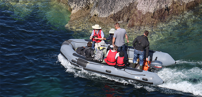
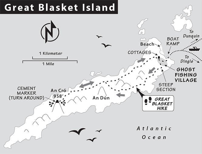
Your boat anchors just offshore from Great Blasket Island. Then you're ferried by zodiac boat to the eastern end of the island, where you'll face the low-tide slippery muck on the ramp. Caution is needed — listen to the boatmen for direction. (This won't be an issue on your return, when high tides cover the hazard.) Double-check to be sure of the departure time for your returning boat.
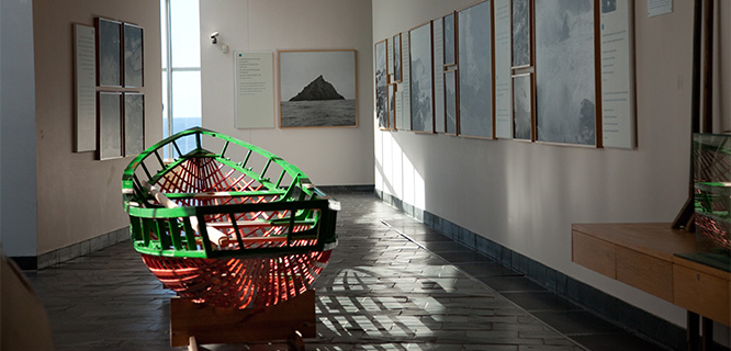
In summer, you'll see guides from the Office of Public Works (which oversees the island) offering hourly free tours of the ghost fishing village above the beach. These OPW tours are well worth the time and bring to life the unrelenting, backbreaking toil in the village (for women) and the long, dangerous days at sea in light, exposed currach fishing boats (for men). Their only relief at the end of a long day was to come together for communal storytelling evenings in their native Gaelic Irish language.
In the early 1900s (when the village population peaked at 160), language scholars came to study the island culture. They encouraged the islanders to write about their hardscrabble lives and to share their storytelling tradition. This is the literary treasure that put the Blasket Islands on the map and brought their traditional lives to light.
Blasket Islanders lived without a priest or doctor, chose a king instead of a mayor, and located an isolated grassy burial plot for un-baptized babies on a coastal outcrop. There is no "clank" or "snap" sound of any hard objects on the island…no gravel scuffs or footfalls on pavement. The moss muffles everything, only letting through the sounds of surf, birds, and breeze.
In 1953, the island population had dwindled to just 22 elderly inhabitants as its young people continually emigrated (often following those before them to Springfield, Massachusetts). The aged left behind on the island were eventually unable to weather the isolation of winter storms. Because of the many preventable deaths from lack of simple medical care, the government eventually moved them ashore to the Dingle Peninsula.
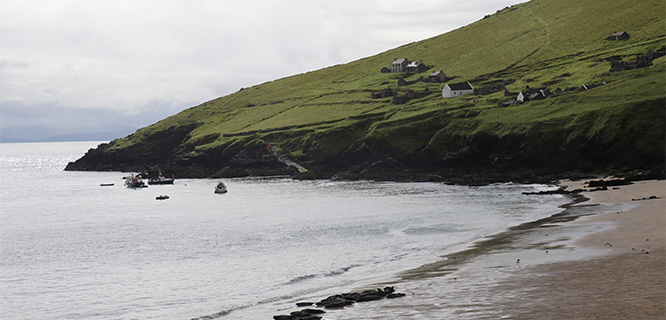
Below the ruins of town, a lovely beach dimples the eastern end of the island. The waters between here and the peninsula hide the wreck of the Santa María de la Rosa, which went down in the "Protestant Wind" storm that scattered the Spanish Armada's wounded ships limping home after their desolating defeat in 1588. In the time of the islanders, cargo flotsam from WWI torpedo attacks deposited unexpected and welcome pickings on shore. But the currents are treacherous, and swimming is prohibited. Those arriving on the first boat of the morning might mistake the dozens of grey seals on the beach for rocks, until they flip their tails (they're dangerous to approach — best left to your zoom lens).
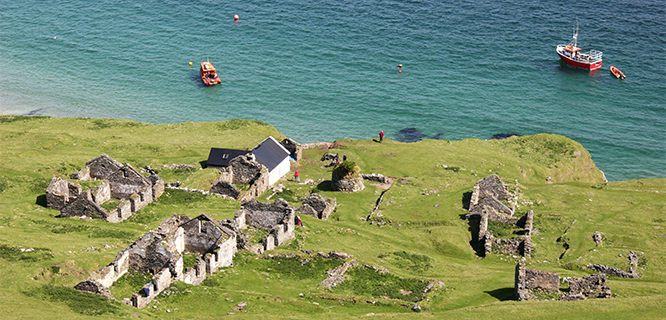
Spot the three whitewashed cottages at the high end of town. They were built in the early 1900s as part of the Congested Districts Board's attempt to relieve rural poverty. One of them, the former dwelling of author Peig Sayers, houses a humble seasonal café. It offers drinks, candy bars, outdoor picnic tables, and momentary shelter from squalls under the good-natured, but distracted, supervision of the cottage caretaker.
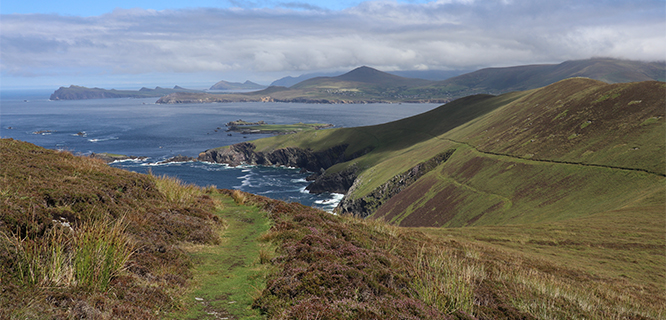
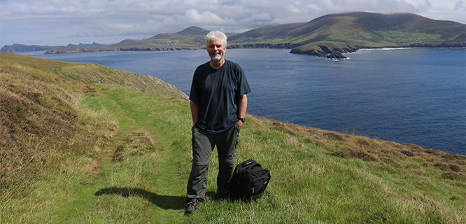
If you're here for a serious hike, don't wait around for the next tour of the village ruins — instead, catch the last one of the day on your way back. Your hike of this four-mile-long ripple of humpback ridges will reach the summit (An Cró Mór, at 950 feet) after about three miles. There's no need to hike farther than that, as the views down on the western end of the island are best from the summit (and the boat won't wait for you as you turn back east). I gave myself two hours of hiking time each way, plus an hour for the OPW tour of the town; the total of five hours on the island proved ideal for my pace with frequent photo stops.
If time is short, consider just the fairly level loop trail around the eastern half of the island, surrounding the lowest and closest ridge above the ghost town. The steepest stretch of the trail is the 150-yard, uphill traverse through the town ruins. Once up on the ridges flanking the slopes, you'll be on spongy and more level ground made of packed moss. Sheep droppings are the main road hazards, and rabbit pellets are unavoidable. I prefer hiking west on the south slope-flanking trail in the morning light, and back east to the village along the north slope-facing trail to catch some afternoon sunlight on headlands extending from this shady side of the island.
The higher and very rewarding heather-flanked ridge trail branches off the loop in the middle of the island. Staying westbound on this spine-hugging trail will lead you to the summit. This is a chance to stride out and enjoy the easy-to-follow trail. Views below to the wave-washed rocks are spectacular. The sharply peaked island in the western distance is Inishtearaght, farthest flung of the six Blasket Islands and often confused with Skellig Michael (geologically similar, but 10 miles away, and visible to the south on clear days).
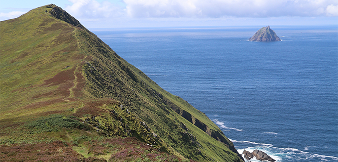
At the stubby concrete pillar atop An Cró Mór, take a few moments to breathe in the views. Then consider that you might be westernmost person standing on dry land in Europe at that moment. Enjoy the downhill return walk back to the dock below the ghost town…and don't miss the boat back. Dingle's pubs won't wait for you to start their evening trad music sessions. And when you hear one sung in Gaelic, picture the mossy poem of an island where that language was once woven into a storytelling tapestry worth celebrating.
Visiting Great Blasket Island
Great Blasket Island is a 45-minute crossing from Dingle town, or a shorter crossing (but a longer drive to reach the pier) from Dunquin. You'll find all of the details in the Dingle chapter of the Rick Steves Ireland guidebook. The Blasket Centre website is another handy information source (including historical photos). If you're getting serious about visiting, invest 10 minutes in watching this instructional safety video.
Weather
Check the weather forecast days in advance and plan accordingly. A visit after a stretch of wet weather will have you walking in moist, spongy moss, so waterproof shoes are a must.
Amenities
Bring everything you'll need to drink or eat, and a light shell to weatherproof yourself from unexpected squalls. Tiny flying midges can be a pest on calm summer days, so bring insect repellant. You'll be on the island between three and six hours. Expect no modern public WC or other amenities.
Helpful Hints
Those who visit the Blasket Centre in Ballyferriter the day before (as part of the Slea Head driving loop) will better appreciate the fishing town ruins, populated by the ghosts of the folk whose stories they learned in the Centre. The loop can be driven using the outline in the Rick Steves Ireland guidebook. Or check out Sciuird Tours, operated by Tim Collins, whose minivan tours of the loop are a highlight.
Tours
On the island, the free OPW tours usually depart at 12:00, 13:00, 14:00, and 15:00. Some choose a guided day excursion, conveniently combining the boat and hike together (based locally from Dingle town). Try Clare Galvin or Kevin O'Shea — independent hill-walking guides who can lace it together for you. Another option is the Peig Sayers RIB boat, operated by Billy O'Connor.
Overnighting on the Island
It's possible to rent a basic self-catering cabin: wood stove, gas cooker, cold shower, no electricity…and an exquisite view from the old bench by the cottage grass campfire pit in the evenings, after the day trippers head home.
Pat O'Connor is the co-author of the Rick Steves Ireland guidebook.